People are drawn to the Tennessee Overhill to explore its beautiful natural landscapes. One of the major draws is the many waterfalls located throughout the forest. There are over 50 waterfalls in the Tennessee Overhill, ranging from 5 feet to 130 feet. Those listed below are easily accessible by Cherokee National Forest trails. Keep in mind, waterfalls are beautiful, but they can be dangerous. In some cases people have been seriously injured or killed while climbing them. Avoid stepping into fast flowing water. If you must walk into a creek, be aware, moss covered rocks can be very slippery. Be sure to bring plenty of water and enjoy the experience. Please, leave no trace while hiking. All of these hikes are considered day-hikes.
Baby Falls 15’ – FS road 210 (Tellico River Rd). Located right next to the road, this waterfall is a favorite for kayakers. Rocks are slippery. Several people have been seriously injured here so enjoy the beauty from a safe distance. From Cherohala Skyway (Hwy 165) take FS road 210. (GPS: 35.3267, -84.1765)
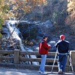
 Bald River Falls 90’ – FS road 210 (Tellico River Rd). These spectacular falls can be seen from the highway bridge on FS road 210. From Tellico Plains take Hwy 165 (Cherohala Skyway) about 5 miles where you bear right onto FS road 210 (Tellico River Road). From that point, it is about six miles to Bald River Falls. At this point, you can also hike on FS Trail 88 to see lesser known falls. The trailhead is located at the falls parking lot on FS road 210. The trail starts at Bald River Falls and works it way upstream. Along the trail you will find Kahuan Falls 10’, Bald River Cascade 10’, Suislide Falls 35’, and Shallow Falls 15’. All the falls are accessible along the trail. Rated easy to moderate. The entire hike is 5.6 miles one way but you do not need to go the entire distance to view all the falls. We do not advise anyone to swim or wade in the river above the falls. The rocks are very slippery and several people have been severely injured and killed when swept away by the water. Located in Bald River Gorge Wilderness. GPS: (Bald River Falls 35.324, -84.17761); (Kahuna Falls 35.3238, -84.1776); (Bald River Cascade 35.3213, -84.17566); (Suislide Falls 35.31886, -84.17462); (Shallow Falls 35.3187, -84.17462)
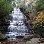
 Benton Falls 65’ – FS trail 131. Located in Chilhowee Recreation Area, the water from Rock Creek cascades down 65 feet of step-like rocks to create Benton Falls. Three mile round-trip hike. Trailhead located at Chilhowee (MacKamy) Lake parking lot. ($3.00 day use fee) Rated easy/moderate. From Ocoee Scenic Byway (US Hwy 64) take FS road #77 to Chilhowee Recreation Area (GPS: 35.14047, -84.5961)
Coker Creek Falls 45’ – FS Trail 183. Three miles round trip. Series of waterfalls/cascades ranging from eight feet to 45 feet high along the trail. Trail connects to the John Muir Trail and Benton MacKay Trail. From Hwy 68 turn onto Bailey Road (located at the “new” Hwy 68 bridge over Coker Creek). Turn left onto paved FS Road 22. Pavement will end, continue for about 3.0 miles where on the left, you will see a Coker Creek Falls sign. FS trail 138 turns left and goes steeply downhill for one mile to trailhead parking lot. (GPS: 35.19727, -84.37028)
 Conasauga Creek Falls 35’ – FS trail 170. Short 1-1/2 mile hike roundtrip. Rated easy to moderate. Traveling on Hwy 68 from Tellico Plains, drive 2.4 miles (sign on Hwy 68), turn right onto FS road 341. Look for the large Forest Service sign. Drive 1 mile on pavement, take right fork, travel 1.4 miles then turn right. This road ends after .5 miles at the parking area and trailhead for FS Trail 170. After seeing the falls, hike a short distance down the creek to see the cascade. (GPS: 35.30422, -84.3315)
Falls Branch Falls 55’ – FS trail 87. About 3 miles round trip. Rated moderate – difficult. From Tellico Plains take Cherohala Skyway (Hwy 165) about 18 miles until you reach Rattlesnake Rock Parking Area located on the left side of the road. From parking area follow the trail about 100 feet to a fork, take the left fork to Falls Branch Trail #87. Once at the falls, you may follow the creek downstream to see several cascades. Roundtrip to falls is about 3 miles. Rated moderate plus. Bonus: You can see a very impressive old-growth forest site with huge trees – poplars, buckeyes, birches, hemlocks, yellowwood, and black cherries. Trees are the largest seen outside of the Joyce Kilmer Forest. Be careful along the last section of the trail near the falls as the rocks will be wet, moss-covered and very slippery. Located in Citico Creek Wilderness. (GPS: 35.35479, -84.0644)
Gee Creek Falls 25’ – TN State Park trail 191. Round trip less than 2 miles. Rated easy. Turn off Hwy 411 in Delano, TN onto Gee Creek Road, which is on the mountain side of Hwy 411. Cross over the railroad tracks and bear right. Travel about two miles. Keep to the right on the road because of limited site distance. Paved road becomes dirt and ends at the parking area/trailhead for the Gee Creek Trail. During the spring the area is covered in wildflowers. At Gee Creek Falls is a small pool that visitors use for swimming. (GPS: 35.247, -84.5261)
Lowry Falls 10’ – FS trail 168. Short hike about 0.4 miles round trip. Rated moderate – difficult. From Hwy 411/Hwy 30 junction near Reliance, travel about 2.2 miles on Hwy 30. Park at Taylor’s Island parking on left side of road. Walk on Hwy 30 for about .15 miles. Sign for trailhead for FS Trail 168 is located on right side of road. Along trail there are several small waterfalls. (GPS: 35.2218m -84.5347)
Turtletown Falls 40’ and Lower Turtletown Falls 20’ – FS trail 185. Round trip 3 plus miles. Rated moderate – difficult. On Hwy 68, turn west at Farner post office, cross the railroad, turn left on Duggan Road, then bear left on Farner Road. FSR #1166 is the first road on the right. Follow the dirt road for 1.5 miles down to the FS Trail 185 located at parking lot. Trail is 3 plus miles round trip. (GPS: 35.1639, -84.35276)
